Télédétection — Susceptibilité aux inondations à Jakarta
2026
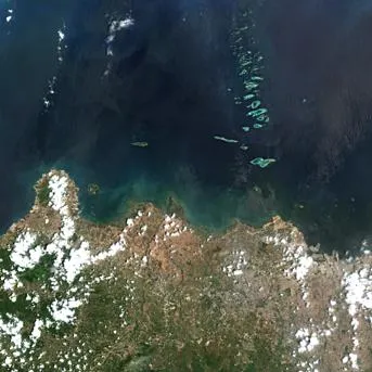
Projet M1 Géomatique à l'Université Paris 8 portant sur l'évaluation de la susceptibilité aux inondations urbaines à Jakarta (Indonésie) par analyse de la perméabilité des sols via télédétection multi-temporelle. Co-réalisé avec TADJER Ali. Contexte : capitale de l'Indonésie devenue première mégapole mondiale en 2025, Jakarta cumule trois dynamiques aggravantes — urbanisation accélérée (imperméabilisation des sols passée de 40,9% en 1975 à 97% en 2020 — Poulain 2022), subsidence du sol mesurée à -25 cm/an dans certaines zones (Dietrich 2020) et climat tropical de mousson (4 500 mm de précipitations annuelles, record 377 mm en une seule journée en janvier 2020 — Mahfudz et al. 2024). 40% de la superficie actuelle de Jakarta se situe sous le niveau de la mer, projection 95% en 2050. Problématique : dans quelle mesure la transformation radicale du paysage urbain de Jakarta depuis 50 ans a-t-elle structurellement redéfini la dynamique des crues, faisant de l'imperméabilisation artificielle des sols l'un des moteurs principaux de la vulnérabilité actuelle de la métropole ? Données : — GHSL JRC (Global Human Settlement Layer) pour le suivi historique de l'urbanisation 1975-2020 — Sentinel-2 (ESA Copernicus) 2024-2025 pour la cartographie haute résolution actuelle — 4 dates clés sélectionnées en saison sèche : 1975 (référence ère Soeharto), 1990 (miracle indonésien, boom économique), 2005 (seuil de rupture, annonçant la catastrophe de 2007 — Texier 2007), 2020 (saturation absolue). Méthodologie : — Pré-traitements SNAP (Sentinel Application Platform, ESA) : corrections atmosphériques Sen2Cor, rééchantillonnage à 10 m, masquage nuages/ombres — Choix méthodologique du bracketing saisonnier (sélection de scènes encadrant les épisodes d'inondation de mars 2025) plutôt que l'analyse directe — validation comparative — Calcul d'indices spectraux (NDVI, NDBI, MNDWI) sur les bandes B4/B8/B11/B12 — Définition de seuils morphologiques justifiés sur l'évolution urbaine 1975-2030 — Cartographie des inondations urbaines de mars 2025 + croisement avec les zones de subsidence Jakarta Nord Résultats : corrélation forte entre urbanisation accélérée + subsidence + zones inondées. Validation méthodologique : le bracketing saisonnier surpasse l'analyse directe. 41 % de la zone d'étude reclassée en zone à risque élevé. Perspectives discutées : projet politique Nusantara (transfert de la capitale vers Bornéo), politiques d'adaptation.